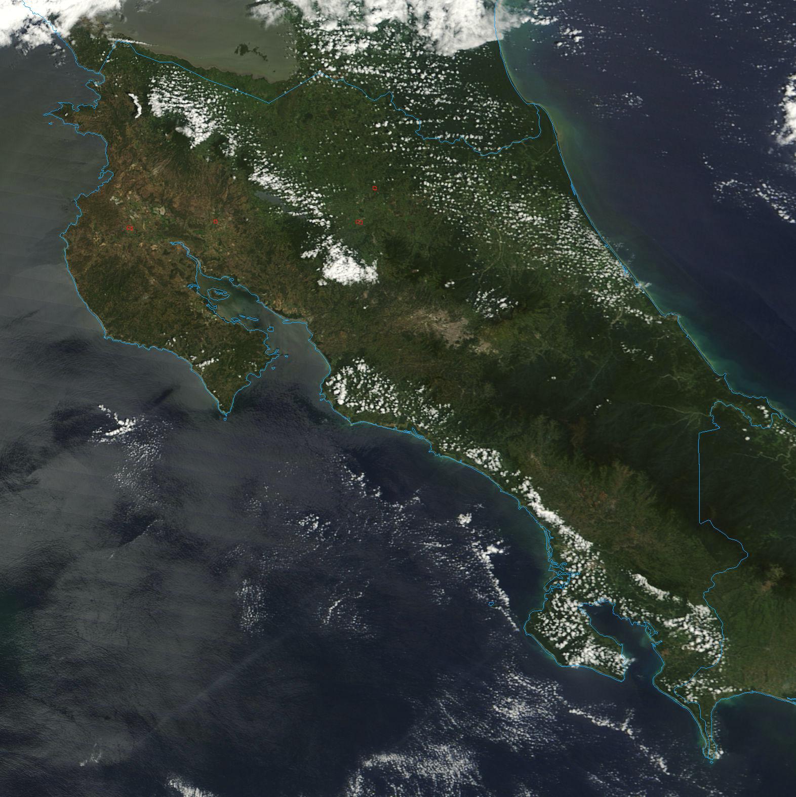
Wednesday, April 17, 2013

The Climate of Costa Rica & more with the Monteverde Cloud Forest


In 1884 climatologist Wladimir Koppen created an intricate climate classification chart. This chart made it possible to create detailed climate graphs for regions all around the world depending on their location, precipitation, and sometimes temperature. Using Koppens chart, we can classify Costa Rica as having an Aw climate. "A" climates are used to categorize areas that have a tropical/humid climate. While Costa Rica does indeed have a tropical climate, it can be further classified as an "Aw" climate because it has dry and wet seasons.
 
In this image here, Koppen's climate classification chart is used in unison with  a world map. Areas are categorized first by their climate (denoted with a capital letter) then by their precipitation amounts and then their temperatures (denoted by smaller letters). If you look closely between the continents of North and South America, Costa Rica is denoted with an "Aw" climate and colored light pink, meaning it has a tropical climate (A) and that it has a dry/wet season (w).
Image Source
  
Even though Costa Rica has wet and dry seasons its climate is relatively stable, meaning temperatures in specific regions of the country move between certain temperatures and don't vary too much year round. The lack of temperature variation in regions of Costa Rica can be attributed to continentality. 
Continentality can be defined by the weather and climate characteristics that impact a location based on its proximity to a body of water.  Land loses and gains heat faster than water, meaning it absorbs incoming solar radiation (insolation) at higher rates.  Water, however, has a high specific heat so that means it cannot absorb heat very fast; so during the day the water is absorbing heat from the sun and collecting it.
Image and Information Source


Since Costa Rica is a small country, measuring only 50,900 square meters and is surrounded by water, its temperature variation is decreased because as the lands cool at night (since land heats and cools faster than water) the heat that the water collected over the day moves from the water over the land. This occurs due to the fact that air always moves from high pressure to low pressure and warm air has higher pressure than cold air.
Image Source
Information Source

 Continentality doesn't mean that the entire country of Costa Rica has a uniform temperature though. In fact, temperatures in Costa Rica change depending on the location of the area and its elevation; the higher the elevation the colder it gets.  These temperature changes occur due to the change in pressure which results from lower and higher altitudes, this process is known as the adiabatic process. 


Here we can see how as an air parcel measuring 30 degrees celsius  moves up, air expands and cools and the temperature begins to drop. As this happens heat is not gained or lost, it is simply redistributed over a larger area, and this makes the temperature feel colder than before. If the air parcel moves back down it compresses and begins to warm. (Notice how the air parcels become larger and smaller in size depending on how high up they are). Image Source

Specifically in the Monteverde Cloud Forest, temperatures here are derived from orogaphic lifting which is associated with the adiabatic process. Orographic lifting occurs when air masses are forced to move from low elevation to higher elevations due to an area's topography. In the case of the Monteverde Cloud Forest, the slope of the Cordillera Tilaran mountain range pushes air up into cooler elevations around Monteverde. Since the air here holds less moisture, excess humidity forms tiny droplets and often takes the form of mist and clouds and gives us the Cloud Forest we see today.


Saturday, March 9, 2013

The Monteverde Cloud Forest


When we think of Costa Rica we often imagine its rain forests and volcanoes; however, Costa Rica is also home to Cloud Forests.

Cloud forests make up only one percent of the total combined woodland areas of the entire world. Costa Rica is home to the Monteverde Cloud Forest which is home to two reserves made to educate tourists and preserve the forest.
Image taken by Jonathon Edwards (contributor) in the Monteverde Forest Reserve


 The Monteverde Cloud Forest (named after the local town) has consistent cloud coverage which allows for constant precipitation (from the clouds) thus giving the forest the water necessary to maintain life. However, surprising as it is, life in the cloud forest would not be where it is now if it were not for the soil properties of the area.Source

There is constant humidity in the forest due to the low hanging clouds and the seasons. Constant moisture gives these plants a perpetual water source and the dark soil provides the plants with the minerals & nutrients it needs to grow.
Image taken by Jonathon Edwards (contributor) in the Monteverde Forest Preserve


Soil can be classified according to its order. There are generally ten to twelve orders of soil, commonly referred to as "sols". In the Monteverde Cloud Forest, the soil here is what most would classify as ultisol soil. This soil may have a slight reddish tint as the concentration of iron and aluminum is higher in ultisol soil than in most other soils. Soils that are red in color often fall under the category of oxisol soil because the amount of iron and aluminum are exceptionally high and because it lacks organic minerals. Due to this, plant life has a difficult time growing in oxisol soil because plants need a varied amount of minerals in order to sustain life.Unlike oxisol soil, ultisol soils do not lack organic minerals and that is because of humus, which is decomposing organic matter.

In this image you can see different types of soil horizons. The horizon with the yellow grass (the top layer) is known as the "O" horizon where organic matter is visible. The dark red soil is called the "B" horizon and this is where minerals removed from above have collected. This is a typical sight for oxisol soil and as you can see from the yellow grass, it is difficult to sustain life in this type of soil without some sort of help.
Image Source


The soil in the Mondeverde Cloud Forest has enough nutrients (or humus) in it to sustain growth. In this image the soil that Charles Schembre found has an "O" horizon, or organic matter (plant life). Underneath this horizon is the "A" horizon which is made up of humus or decayed organic matter. This horizon provides the necessary minerals and nutrients that plants need in order to grow. The "B" horizon is located just beneath the "A" horizon and it is composed of minerals that have fallen from above and collected in this layer. Roots of plants are noticeable in this layer until it reaches the "C" horizon (not seen in this photo).
Image Source


Humus, mixed with the precipitation gathered from the overhanging clouds, and the forest's mild temperatures, makes soil here in the Monteverde Cloud Forest extremely valuable for growing vegetation and even sustaining wild life. Deforestation, however, is  dangerous because it threatens the biodiversity of the area and destroys the habitats of all the animals that call this forest home. It also depletes nutrients in the soil for the area and in doing so, destroys the plant life that thrives in this region. Source

"The condition of soil is one of the most important factors in the productivity of forest ecosystems ..Agricultural practices and operations in the tropics are notoriously correlated with the rapid destruction of forest ecosystems and rapid biodiversity declination of flora and fauna. Tropical Montane Cloud forests are among one of the most threatened ecosystems in the world due to land clearing for grazing and other agricultural operations. When forests are cleared, and replaced by grazing, considerable changes occur to the natural physical and chemical properties of the soil. If attentive soil management is lacking, the land becomes exhausted and infertile". (Charles Schembre)
Information source
Image provided by Jonathon Edwards (contributor) in Costa Rica outside the Monteverde Cloud Forest Preserve.

The Monteverde Cloud Reserve is home to 2,500 plant species, 100 species of mammals, 500 bird species, 120 reptilian and amphibian species, and thousands of insects. The highly diverse ecology of The Monteverde Cloud Forest contributes to its soil properties. However, all of this is in danger if humans continue practicing deforestation in the area. If the trees are destroyed here, the humus decreases and becomes unable to replenish the nutrients in the soil that are required for continual growth and life sustainability.
Image Source
Information Source

Tuesday, February 12, 2013

Volcanism In Costa Rica


There are currently six active volcanoes and 61 dormant or extinct volcanoes in Costa Rica!

This is a list of the major volcanoes reported by the U.S Geological Survey.
Image Source
The volcanoes of Costa Rica were formed by the subduction of the Cocos Plate under the Caribbean Plate. In the image below we can see how the Cocos Plate subducts under the Carribean Plate. The Cocos Plate subducts under the Caribbean Plate due to the difference in densities. The heavier of the plates (Cocos Plate) subducts underneath the lighter one (Carribean Plate). This subduction, however, is shallow. While the plate itself is subducting under the Caribbean Plate into the asthenosphere (denoted by the yellow), the melting of rock and creation of magma beneath Earth's surface is taking plate in the lithosphere. The friction that is occurring due to these two plates rubbing against one another is what creates magma. Eventually, the pressure of the gasses secreted by the magma escapes by tunneling through the lithosphere and breaking through the surface of the earth. Once magma reaches the earth's surface, it is called lava. Through various eruptions and the cooling of lava, a volcano is created.
Diagram of the Cocos Plate subducting under the Caribbean Plate.
Image Source


This is a view of the Arenal Volcano taken from the Arenal Springs hotel.
Image Source


The Arenal Volcano was created by these subducting processes. The Arenal is a type of volcano called a stratovolcano. Stratovolcanoes have a tendency to occur in subduction zones! These types of volcanoes are built up by strata of tephra (or volcanic ash) and hardened lava created by various eruptions over the lifetime of a volcano. The Arenal Volcano itself is a very young volcano with the predicted age of 7,500 years—and still building! The rocks that make up the volcano are basaltic andesite, which means they are extrusive-igneous rocks and dark in color. These rocks melt and erupt in the form of lava that moves slowly, this slow movement helps stabilize the loose material that is gathered around the volcano's cone and prevents the cone from collapsing. 

Arenal erupting, slow moving lava.
Image Source


Saturday, January 26, 2013

Who are we and what are we doing?

We're Students

This blog was created by: Sara Farfan, Jonathon Edwards, and Linda Fu. 
My name is Jonathon Edwards and I am an Environmental Science major at UCD.  I have chosen Costa Rica.  I love Costa Rica for its diverse ecosystem and many microclimates.  Costa Rica has a lot to offer from its beautiful dive locations, awesome beaches, volcanic activity, cloud forest and amazing rivers.  Traveling through Costa Rica is an eco tourists dream, I love this place!  The diverse array of plants and animal is breath taking. The physical geography of this place is vast and I look forward to researching it further.   
Beautiful right? This is the Arenal Volcano located in the
Northwestern part of Costa Rica. It's still active,
in fact, its last eruption was in 2010!
Image Source

My name is Linda Fu and I'm an Elementary Education major. I'm excited to contribute to our geographical study of Costa Rica mainly because it's one of those places I heard about continuously while growing up. When I think about Costa Rica now, the first thought that comes to my head is "zip lining through trees"  and while that's a fun idea to associate with Costa Rica, I'd really love to examine Costa Rica, not just for its tourist attractions, but for the breathtaking landscape that not everyone gets to see. 
Costa Rica is famous for its scenic views of mother nature, but we're
hoping to learn more about the "behind the scenes" processes
that have made Costa Rica what it is today.
Image Source
My name is Sarahellen M. Farfan, also a student from UCD. I'm currently attending school to get my bachelors degree in accounting. I decided to join the project exploring Costa Rica for my geography class simply because there are many interesting facts about the country. I thought it would be a mind opening experience to explore the physical geography and climate of Costa Rica, did you know that there are currently six active volcanoes there? I'm also highly interested in learning more about how the various types of vegetation in Costa Rica helped to form the ecosystem we see there today!